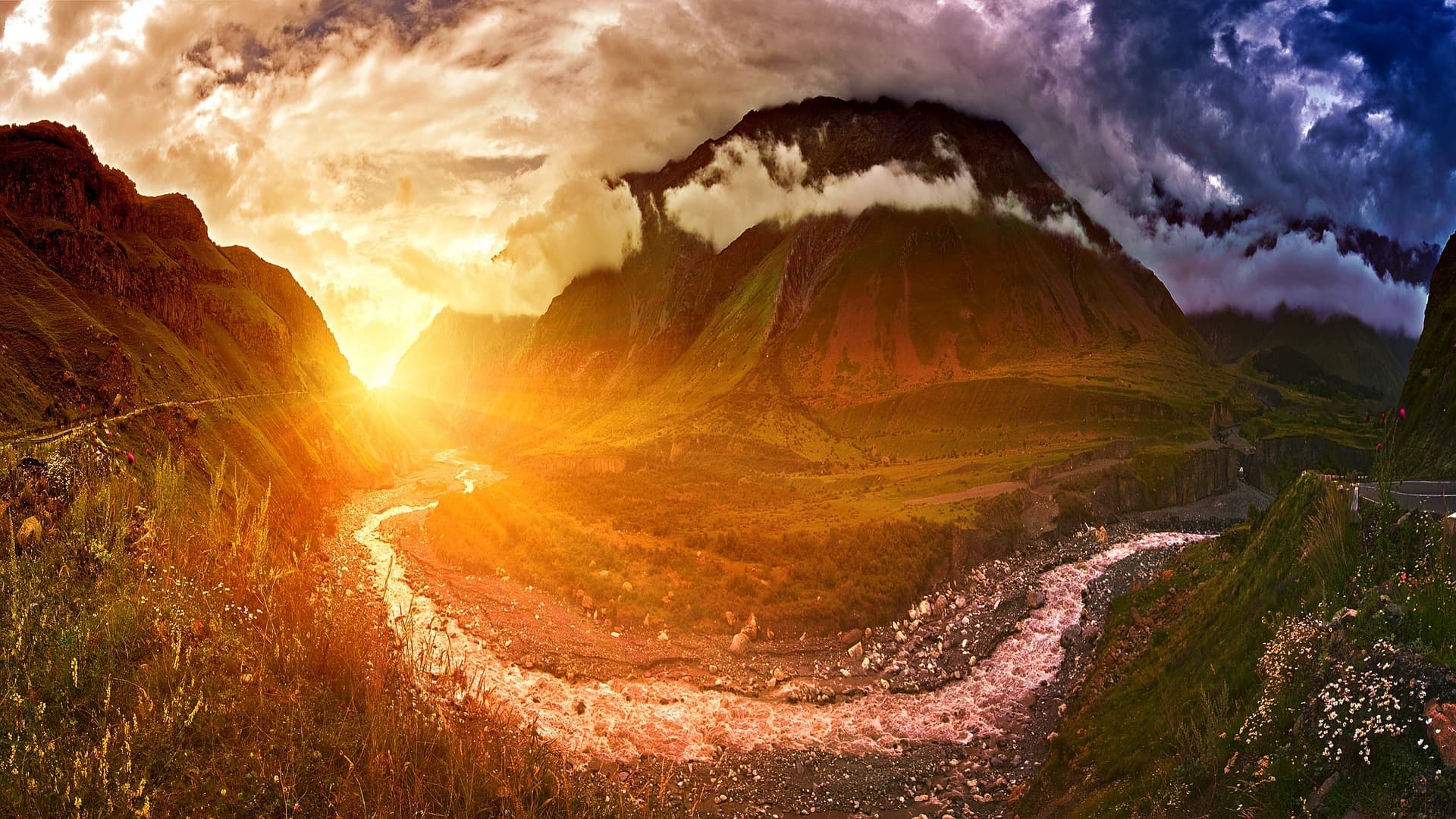
Geography of Georgia
Physical Geography of Georgia
Georgia, with a total area of 69,700 km², is one of three countries in Transcaucasia. This mountainous country, with a subtropical climate, borders the Russian Federation to the north, Azerbaijan to the east, Turkey to the southwest, Armenia to the south, and the Black Sea to the west.
Mountain ranges and plateaus occupy 80% of Georgian territory. Despite arable land comprising only 18% of its total area, Géorgie is considered an agricultural nation.
Villages, towns, and rural communities are often situated at higher elevations, except where they line the shores of the Black Sea, such as Poti, Sukhumi, and Batumi. While the Georgian capital, Tbilisi, sits at an average elevation of 572 meters, other villages occupying the high peaks of the Caucasus sometimes present challenging access.
Land of the Caucasus
The Greater Caucasus, located at the Russian border, features several snow-capped summits year-round, with some rising above 5,000 meters. Among the well-known peaks of the Greater Caucasus are Mount Shkhara (reaching 5,193 m) and Mount Kazbek (reaching 5,047 m).
The Lesser Caucasus, in the south of the country, has an average elevation of 2,000 meters. Peaks rarely exceed 3,300 m in altitude. Nevertheless, this mountain range unfolds diverse landscapes resulting from intense seismic activity. The Lesser Caucasus consists mainly of high volcanic plateaus interspersed with significant lava flows shaped like terraces. The terrain, composed of numerous folds, is relatively gentle.
The Surami Range crosses Georgia from north to south, dividing the country into two parts. Western Georgia (formerly known as Colchis) experiences a subtropical climate with mild winters and hot, humid summers. Eastern Georgia (ancient Iberia) has hot, dry summers and moderate winters.
Modern Georgia is subdivided into 12 administrative regions and two autonomous republics (Adjara and Abkhazia).
Svaneti Region
Svaneti is a region located in the northwest of Georgia. The rivers Tskhenistskali and Enguri wind through Svaneti's impressive gorges and highlands. Bordered by high peaks rising between 3,000 and 5,000 meters, this region is considered the most elevated in Europe.
Following the southern slopes of the Greater Caucasus, Svaneti comprises the Inguri, the upper Riom valley, and the Tskhenistskali. Historically and geographically, the region is divided between Upper Svaneti (Mingrelian-Upper Svaneti) and Lower Svaneti (Ratch-Lechkhumi and Lower Svaneti).
Guria Region
Guria is bordered to the northeast by Imereti, to the north by Mingrelia, to the south by Adjara, to the southeast by Samtskhe-Javakheti, and to the west by the Black Sea. This region, situated in western modern Georgia, comprises the districts of Lanchkhuti, Ozurgeti, and Chokhatauri. Rising to 800 m above sea level, the region's highest point is Sakornia Peak. The climate is both humid and subtropical, characterized by mild summers and gentle winters.
A particularly rich and specific flora distinguishes this region. It boasts more than 1,000 varieties of different plants, ranging from peatlands to subalpine forests, passing through subalpine and alpine meadows.
Ratch-Lechkhumi Region
The region of Ratch-Lechkhumi and Lower Svaneti is an administrative region situated in northwest Georgia. This particularly mountainous region has Ambrolauri as its capital. It comprises the historical provinces of Lechkhumi, Ratch, and part of Svaneti.
Ratch-Lechkhumi is a region bordering Russia to the north. In fact, the republics of Kabardino-Balkaria and North Ossetia border the watershed line of the Greater Caucasus.
The region is delimited to the east by the Likhi mountain range. This separates the region of interior Kartli from Ratch-Lechkhumi and Lower Svaneti. To the south, Ratch-Lechkhumi adjoins the Imereti region. The ranges of Svaneti and Egrisi mark their boundary with Mingrelian-Upper Svaneti to the west.
The entire region is blanketed with dense forests and alpine meadows. It also abounds in lakes, mineral spring sources, waterfalls, rivers, and caves. To this effect, two caves discovered in 2001 in the region extend over 5 km of galleries.
Imereti Region
Imereti, or sometimes Imeria, located in central Georgia, is surrounded to the west by Guria and Mingrelian-Upper Svaneti. It is delimited to the east by interior Kartli, to the north by Ratch-Lechkhumi and Lower Svaneti, and to the south by Samtskhe-Javakheti. The region, situated at 125-300 m above sea level, is crossed by the Rioni, which later flows into the Black Sea.
To the northeast, Imereti is surrounded by high mountains rich in mineral resources. The Likhi peaks and the Meskheti mountains border the region to the south. West of the Likhi mountains unfolds Colchis, or the Rioni plain. Colchis is indeed fertile land, filled with fresh springs, lush forests, verdant fields, and gardens. Generally, winters are mild and summers fairly warm in Imereti.
Samtskhe-Javakheti Region
Samtskhe-Javakheti is an administrative region situated in southern Georgia. This mountainous region consists of two historical provinces: Meskheti and Javakheti. It has Akhaltsikhe as its capital. It is surrounded to the west by Adjara and Guria, to the east by interior Kartli and Lower Kartli, to the north by Imereti, and to the south by Armenia and Turkey. Rising between 1,000 and 1,300 m above sea level, this region offers contrasting landscapes. These range from subalpine forests to volcanic canyons located near the Vardzia site.
Kartli Region
The Kartli region, located in eastern Georgia, borders Tbilisi and its surroundings. It is often nicknamed "the heart of Georgia." Major routes once traversed Kartli, including the famous "Silk Road," which connects Western Europe to India. This region, with its dry climate, nevertheless displays fertile lands rich in fruits and vegetables. The landscape varies between lush forests and verdant valleys. It is also an extremely rich region in fresh springs and mountain streams.
Kakheti Region
The Kakheti region, with Telavi as its capital, is located in southeastern Georgia. The Gombori mountains divide Kakheti into two parts: interior (Chida) and exterior (Garé). The most fertile part of the region lies north of the Alazani valley. It surrounds the peaks of the Greater Caucasus, with summits rising above 3,000 m in altitude. Subalpine and alpine meadows line the slopes of this part of the region. The climate in Kakheti consists of cold winters and very hot summers.
Khevi Region
Khevi is a region of eastern Georgia rising to approximately 1,740 m above sea level, on the slopes of the high mountains of the Greater Caucasus. The gorges of the Trusso, Snostskhali, and Tergi rivers converge in this region. Khevi's landscape is shaped by alpine meadows dotted with yellow rhododendrons, waterfalls, mountain passes, and the snow-capped Mkinvartsveri. In short, Khevi is the best place in Georgia to glimpse roaring rivers and towering peaks.
Khevsuretia Region
Khevsuretia is the region situated on the slopes of the Greater Caucasus mountains, in the eastern mountains of Georgia. Generally, the landscapes of the region are of an alpine character. Mountain trails, torrents, and glacial waterfalls complete these vistas.
Mtiuleti Region
The Mtiuleti region, located in eastern Georgia, rises to 1,050 m and comprises the gorges of the Tetri Aragvi river. It is delimited to the south by Mtiulkari, to the north by Trusoskari, and to the east by Khevi. It also borders the Gudamakari and Lomisi gorges to the west. Its landscape consists of alpine meadows of yellow rhododendrons, refreshing waterfalls, deep gorges, and vast glaciers adjoining mountain passes.
Pchavi Region
In the mountains of eastern Georgia lies the Pchavi region. It is bordered by Khevsuretia to the north, the Gudamakari gorges to the west, and Tianeti to the southeast.
Samegrelo Region
The Samegrelo region, in western Georgia, is girdled by the deep rivers Tskhenistskali, Rioni, the Black Sea, and Enguri.
Tusheti Region
Tusheti is a high mountain region situated in the eastern part of Georgia, at 1,500 m above sea level, between Dagestan (Russia) and Kakheti. The region is divided into 4 historical zones, including Gometsari, Tusheti, Tsova, and Chalma. Nature here is extremely harsh. Indeed, even during summer, cascades of frozen water, lining the winding roads of Tusheti, form a striking contrast with verdant valleys. Alpine and subalpine meadows, fields, pine forests, and scrubland complete this exceptional landscape.
Autonomous Republic of Adjara
Situated in the southwest of the country, Adjara borders the Turkish frontier to the south, is surrounded by the Black Sea to the west, and borders the regions of Samtskhe-Javakheti and Guria to the east and north.
Adjara, with Batumi as its capital, is characterized by the magnificent coastline of the Black Sea, a mild subtropical climate, and exotic plants. This has earned it the nickname of the "Adjara Valley" or the "Land of Adjara." The region remains verdant even during winter.
Most of Adjara's territory is occupied by the Lesser Caucasus mountain range, whose highest point rises to 3,007 m. Forests cover 186,965 hectares of Adjara's total area. As for Adjara's waterways, they all flow into the Black Sea basin.
Autonomous Republic of Abkhazia
Abkhazia has an area of approximately 8,600 km². This Georgian autonomous republic is located at the far west of the country and also on the northern coast of the Black Sea. The climate there is very mild. Abkhazia is highly mountainous, with 75% of its area considered piedmont. Within the Abkhazian mountains lies the Krubera-Voronja Gorge, the deepest natural cave in the world known to date. Discovered in 2004, this cavity features a depth exceeding 2,000 meters.